First results from our wildfire research
We are happy to share that our recent research on monitoring of the Greek wildfires using Sentinel-1 SAR data, presented at the IEEE Geoscience and Remote Sensing Society (GRSS) conference IGARSS 2023, is finally published. The paper named “Unsupervised Burned Area Mapping in Greece: Investigating the impact of precipitation, pre- and post-processing of Sentinel-1 data in Google Earth Engine” was published in the IGARSS 2023 – 2023 IEEE International Geoscience and Remote Sensing Symposium conference proceedings.
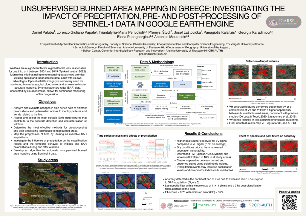
🔥 We highlight the potential of utilizing all available Sentinel-1 SAR data for wildfire monitoring through unsupervised clustering. We focused on exploring the impact of precipitation on post-fire SAR backscatter, selecting the right SAR input features, and optimizing speckle filters and post-classification techniques.
Key findings:
👉 We successfully classified the wildfire progression using SAR data and unsupervised learning with the best F1-score of 0.76 and omission error of 19%.
👉 The Lee speckle filter with an 11×11 kernel window size and a 2 ha post-classification filter outperformed other combinations.
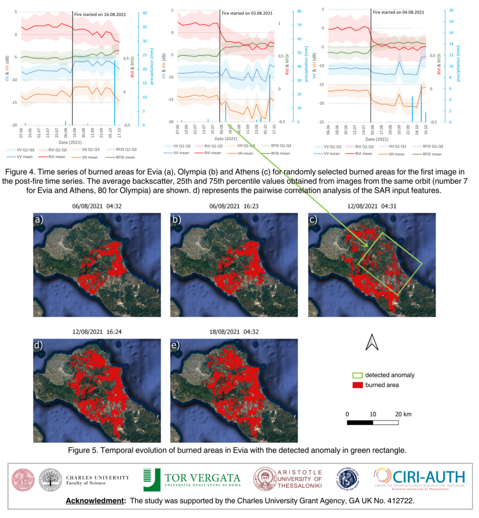
👉 Precipitation before SAR acquisition can significantly influence post-fire backscatter, particularly in VV polarization. We identified an anomaly in the classification attributable to precipitation.
👉 Time series analysis revealed distinct post-fire SAR backscatter behavior for different land cover types: a decrease in forested areas (Olympia and Evia) and an increase in shrublands (Athens).
The extension of this work with an algorithm for automatic wildfire progression monitoring using Sentinel-1 SAR data in GEE is currently under review, so stay tuned!
You can access the full paper here: https://ieeexplore.ieee.org/document/10283130
Google Earth Engine codes for time series analyses and speckle- and post-filter optimizations can be found at the GitHub repository: https://github.com/palubad/S1BAM-IGARSS-2023
Authors:
Daniel Paluba, Lorenzo Giuliano Papale, Triantafyllia Perivolioti, Premysl Stych, Josef Laštovička, Georgia Karadimou, Panagiotis Kalaitzis, Elena Papageorgiou and Antonios Mouratidis.
D. Paluba et al., "Unsupervised Burned Area Mapping in Greece: Investigating the Impact of Precipitation, Pre- and Post-Processing of Sentinel-1 Data in Google Earth Engine," IGARSS 2023 - 2023 IEEE International Geoscience and Remote Sensing Symposium, Pasadena, CA, USA, 2023, pp. 2520-2523, doi: 10.1109/IGARSS52108.2023.10283130.
This work was also presented as a poster at the IGARSS 2023 in Pasadena, California. The poster is available from here: